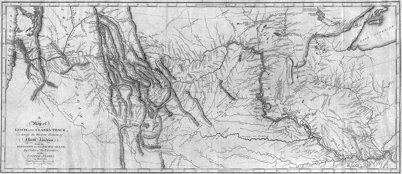
Public Domain, Library of Congress, via Wikimedia Commons
Map of Lewis and Clark’s Track (1814)
William Clark (cartographer), Samuel Lewis (engraver) • 1814
The first published map based on Clark’s cartographic work during the expedition, showing the route from the Mississippi to the Pacific. One of the most influential maps in American history, it served as the primary cartographic record of the trans-Mississippi West for decades.