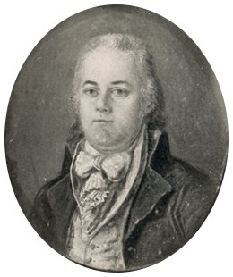
Andrew Ellicott
Andrew Ellicott (1754–1820) was a prominent American surveyor and mathematician who provided Meriwether Lewis with crucial training in celestial navigation and cartographic methods in the spring of 1803, as Lewis prepared for the expedition. Ellicott taught Lewis to use the sextant, chronometer, and other instruments to determine latitude and longitude—skills essential for mapping the uncharted West. He had previously surveyed the boundaries of Washington, D.C. and the Mason-Dixon Line.
Portrait: Public Domain
Biography
Andrew Ellicott (1754-1820) was one of the leading surveyors and astronomers in early America. He taught Meriwether Lewis the essential skills of celestial navigation, mapmaking, and computing latitude and longitude — training that was fundamental to the expedition’s scientific mission.
In the spring of 1803, President Jefferson arranged for Lewis to study under Ellicott in Lancaster, Pennsylvania. Ellicott taught Lewis how to use the sextant, chronometer, and artificial horizon to determine geographic position from celestial observations. He also instructed Lewis in the use of the surveyor’s compass and the mathematical computations needed to convert observations into coordinates.
Ellicott had previously surveyed the boundaries of the District of Columbia, the southern boundary of the United States (the 31st parallel), and numerous state boundaries. His reputation as the nation’s foremost practical astronomer made him the ideal teacher for Lewis.
The geographic data that Lewis and Clark gathered using Ellicott’s methods produced the most accurate map of the American West for decades — a direct result of Ellicott’s instruction. Without this training, the expedition’s cartographic achievements would have been impossible.

