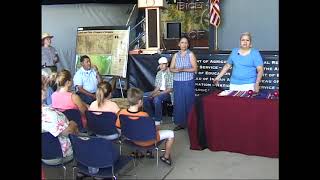
Tent of Many Voices: 11080601F
he is our mentor and our teacher and is he here he'll be here tomorrow he'll be here tonight all right well if not tell him hi from howdy from Candy from Candy we traded out at uh West Virginia uh with the culture there was like three like a circuit of three days we traveled around West Virginia with the cultural either the cultural State preservation liance something like that fantastic oh it's you guys have a great program good thank you we appreciate that we're trying to do our part by talking up just the hair oh good yeah it's I think they're up and coming I really Do's good research coming out of there got a beautiful region I just love St thank you I'm sorry not to be there right now I got to tell you Omaha's a big difference but I love it too it's something about every place you get where do you carista what time do you have is this ready it was nice to meet you C nice to meet you too I'm to hang the more all right well don't feel like you have to stand now okay like to welcome everybody we're going to um be pres give your visitors this facial treatment and before I get into our names and everything I just want to say thank you for coming that means the world to us we have really poured a lot into this and we hope that comes through in our presentation and also just thank you for supporting ni supporting it's really important to our field and we hope to be there you know for many many years big thank you thank you to everybody who has helped us in little secret ways you know who you are you are out there so thank you for that and so with that I I'll start with just kind of a quick introduction I'm chisa De Carlo and I currently work for the Louis CL National histor tra and and so let me we'll kind of move in I'll let Heidi go ahead and introduce okay just a little bit about excuse me about myself first off there's some more seats up here that you you like to come forth go right ahead there's three or four or five up here there's four seats if you'd like to come on up don't be shy my name is Heidi and I just graduated from West Virginia University with my masters in recreation parks and I have a bachelor's degree in geography which is what got me interested in math in the first place and I worked for a short time summer seasonal at the Louis and Clark interpretive Center in Great Hall Montana so that's sort of my interpretive background and I focused my Master's thesis research specifically on Geographic interpretation and a lot of that and our presentation comes out of that so I'll turn it back over to Carissa so um as you can see I'm Carissa de there I'm pictured in front of our illustrious math of our illustrious mobile outdoor exhibit the cor Discovery 2 which the Lou and Clark National Historic Trail has been um heading up the past four years and just put the bed but we'll talk about that a little bit a little bit about me um I grew up in Louisiana I got a yes renable resources from the University of Louisiana so I'm a raan Cent and then did my Master's works at West Virginia University I'm also wrecking parks and um we we got through that together that that's something that is really cool that's how we kind of established our relip and I'm the theme junkie how use the map junkie I'm the theme junky if if you're trying to do something without a theme I get really weirded out by that that in here quite a bit but um just to give you a little bit of background of where we're coming from there that's that's our story and where we come up with all this walking around the gym at the student recreation center at West Virginia University so exercise can lead to some really good things um and with that I want to talk just a hair about the uh recent Lis and Clark National Historic Trail exhibition that was going on um we just put this to bed but the point of it is I'm going to use it for an example and a touch Point um throughout this program so I'm going to give you a little background um 200 years ago M Clark traveled across the country and came back there's a really huge key of what they came back with they came back with a MTH but we're going to say that for later this is what our exhibit looks like from a bird I view and the thing about Core 2 which is really special is that it was a mobile National Park we actually went to different communities set this thing up we experience the landscape of the leou and Clark Trail which is no easy feat being that it crosses 11 states with its Western Legacy and if you want to talk about Eastern Legacy well it gets bigger this exhibit was actually set up in aluer in 2005 so um we've been here before and it is heralded by that potato chip look intent right there called the T of many voices and inside of there was something going on that was pretty unique and pretty special for National Park Service we invited speakers from all different cultures all different walks of life all different agencies to come in there and speak freely about their connections to the trail to the story to the landscape and to their little town um that is pretty amazing we're putting our name on something thing and yet we did not have anything to do and so with that kind of giv you just a little feel for what Core 2 was travel for four years we just ended in September and at the end of the day we hit 93 communities across the us and we also heard over a yearly 5,000 presentations of that so you want to talk about getting spatial Geographic go to the source go to those places but with that no good present is possible without and so I didn't want to hide our theme you know sometimes you don't just write out bring it out and say it but this is what we're striving to be today in here um we want to kind of encourage you to think about geographic interpretation we want you to take this home to your site to your place where you work and you're doing these things um we want you to think about the power of a MTH and we're going to back this up we're going to give you some good things that will really bring this home and really it's about stories and for in W here we are sharing the stories we want to help you share the stories on your landscape and so where are we going I'm going to give you that little outline help you kind understand what we're going to do today we'll start with the virtual tour of Albuquerque it's going to be geographically based and we're going to give you the little nuts and bolts in science of the case for Geographic interpretation we'll go over a little bit about how we learn from maps and then we'll talk about map design so when you go home and you look at the map at your site May pop up with some after that so um with that we're going to turn it over to Heidi who is our virtual tour Guru on this collaboration we've had a few more people come in so please come forward there's a couple of seats here and a couple people here want you to be comfortable I know it's after lunch so if your neighbor starts fall as sleep just give a little elbow for me I'm going to start off by giving you a little virtual tour of the Albuquerque area and part of the reason that I'm doing this is to let you know that this is a resource that you can use at your site I used a program called NASA World wind has anybody heard of this before one person all right well good we're two people we introducing something a little bit new it's a lot like Google Earth how many people you are seeing Google Earth okay a lot of you the problem with Google Earth is that it's a commercial application in many of you if you work at government sites you may have been told you to not use it NASA worldwind is very similar but it's a government application and it's completely three and so you're welcome to use this at your s I'm going to use this initially to orient ourselves within the landscape and then we're just going to quickly explore how the geography of the Albuquerque area has really made this city what it is today so while I am going out to this I'll just share a little bit with you about this program that I used you can use it interactively right on the internet so if you have a computer terminal set up in your site people use this um real time I had to record this video actually because they don't have internet in these classroom so it gives you both those options whereas Google Earth the free version you're not able to record any of the images to come off the web so since we're from all over the country is anybody from outside of North America one person okay well a couple of people I apologize then that this doesn't Encompass everybody but for the most of us came from somewhere in North America all right here we go we're going to zoom in to this lovely planet that we all know as planet Earth right into North America and to the desert Southwest that little star right there in the middle is centered right on where we are at this moment the Albuquerque Convention Center you're going to see the colors change we're going to be looking at some high resolution images of the City of Albuquerque and we're going to zoom from outer space all the way right down to the aler convention center anybody recognize that right just to orient you a little bit this is the Eastern complex the Western Complex which is where we are right now and the plaza that's outside so now you can kind of get an idea of what it looks like from a bird's I view and we'll even see some pictures kind of up close here oh my God these pictures are all from the Whirlwind um the satellite images are the ones I just showed you I inserted from a website called local live weite what's it called local live and we're going to be handing out um something later that we'll have these websites on there for you oh great so as we're zooming back out again kind of get your bearings do you see maybe the hotel you're staying in or the road you drove in on to get here today perhaps you can see where you put your car these images aren't real time so you wouldn't be able to actually see your car the road across the top that's lus anybody have any idea what this road is Route 66 right okay so that gave you a little overview of the city and now we're going to travel down to Oldtown how many people have been to Oldtown right now several people good once you get out of here today go down there have Margarita kick back and enjoy it Oldtown when was Oldtown established 300 years ago this is the birthday of Albuquerque this year so please wish it a happy birthday now we'll get a few shots of the San felipi church and the plaza there in the front have y'all seen that the ones that have been down there okay if you go down there remember these pictures as we Zoom back out again I want you to notice where Oldtown originally developed on the left you're going to see in a minute the Rio Grand River which flows through here there have been many many cultures in the Albuquerque area from the PUO to the Spanish to New American many many others they've all shared one common need and that's water if you have notice already we're in the middle of a very hot dry desert it's not so hot right now but it can be look at the size of aler now quite a bit larger than Old Town originally was 300 years ago the Rio Grande river does not supply enough water for the people of Albuquerque what we're going to look at now is we sort of zoomed out to a different scale here we're looking at a landscape scale and we're going to see how the geography of this area has enabled all of us to be here today Apple turque wouldn't be what it is today if it doesn't the geography of this area so right now what we're going to do we were looking at a bird's eye view of the landscape we're going to sort of rotate that up and we're going to see the landscape from sort of an oblique or a side view does anybody know what this feature is here Mountain I see if how many people were at the presentation this morning um do you remember what Sandy be watermelon right just to the south of that down here are the monzano mountains what does that mean apple apple I encourage you this week to catch a Sunset and look at these mountains of sun because that is how they got their names beautiful color that they display Sunset the Sandy mountains I talked I said we were going to look at the geography of this area they are essentially a big black of granite that popped up out of the Earth's surface and formed kind of a lip or a rim to this Valley here it's just like if you were to walk around your patio and you had a loose brick you stepped on one side one side pops up in the other sinks it's kind of the same effect it's just a big block of granite that's popped up out of the Earth surface you can kind of see why the city has developed here because that side that's raised up is very dramatic and beautiful because it's so um steep you can see on the back side that it slopes away much more gently so again I want you to think of this as sort of a rim or a lip on maybe like a big sink or a big tub now we're going to rotate our view look out across the valley you see the Rio Grande River snaking through the middle there and then out to the West on the other side there is What's called the West Mesa if you've been in say the Double Tree Hotel and if you've looked out your window can you see the West Mesa the rim of it take a look if you get a chance to get up high you can actually see the rim of the West M it doesn't show up well in here but this is it this area has also been lifted up not as dramatically as the sand is have you seen any other evidence over on the west side of uplift or moving of the Earth's crust volcano right there's five volcanoes that are along the skyline of Albuquerque and those are right here they don't show it very well in this imagery but so if you get up into the Double Tree or someplace hi take a look at those five volcanoes they are now extinct so don't worry what's happened now is you have the lip on the right or on the East and then you have this lip on the west that was formed by the West Mesa so as the Earth lifted up and pulled apart what happened in the middle right it's kind of collapsed and sank down now you probably think well Apper is really not all that deep that's because of the real gradley River we have the Rio gradley to thank for that we normally think of rivers flowing through an area and gouging out of deep valley the Rio Grande has done the opposite its main function through history has to been to come through here and deposit sand silk gravel and it build up this great big trough or hole in in the earth that formed here the reason that's important is I want you to think again we were talking about this like a big Basin or sink imagine now laying a towel or a big sponge in the bottom of that sink there's lots of little porous areas and air holes and what does it do fills up with water right it trickles down from the it fills up with water it's formed a great aquafer beneath aler so this the reason I wanted to show you this was that it's the geography or the arrangement of these features the mountains the Mesa the Rio Grande river that have allowed that Aqua Aqua form Albuquerque receives 100% of his water from this Aqua so next time you take a shower turn on the tab think about that it's the geography of this area that's allowed you to do that otherwise they just probably could not be as many people the S as are with that in mind it's not an unlimited resource it's renewable but not unlimited so please conserve a little bit so that's the end of my video here we looked at how the Sandia Mountains on the East the West Mason and the Rio grandi River how their particular spatial Arrangement has created this very valuable resource for people here so with that back right on back to the PowerPoint and I don't know if we mentioned at the beginning but if you have questions during the presentation if you could jop them down and we'll address them all at the end that way we can make sure we hit everything okay and just to check if you're listen who remembers what uh mon means okay or somebody raised their hand and screaming because I have give WS all right apple apple you're student you need things right okay all right CIA all right there we go got watermelon there okay there you go you got to write home about your tour okay um what's Mesa mean table T table okay somebody 66 just my so what we're trying to get across in this presentation is that geography is important because what happens wherever you guys are what happens is directly related to where it happens and this is just a little side view if you were having trouble visualizing the aquifer there's the West Mesa SAS Rio Grande and aquafer all right so at that point I will turn it over to Marissa oh man okay well thank you for coming and of course giving us a chance to give you a little bit of that special treatment we wanted to promise you a little spatial today so there we go that's kind of part of our goal there but we've got to get into the nuts and Bol and we got to make the case for this um with that research background we're trying to do it so we got to do it and um we want to start with the big picture and that's just geography as an idea geography is related to everything doesn't really matter and so I love to look at this and think of um the seven degrees with Kevin Bacon how we can all somehow find a relationship to Kevin Bacon we can but we don't have time for that today but we can well geography is like that but it's even better it's like 7° like quadruple PL so remember that this is a good thing for you and everything is going to come back to this I don't care what site you're working at geography has played a role there it's really important because so many of us are trying to interpret large Landscapes these days we're trying to talk about these really big scale ideas and um particularly you know habitat corridors a fire regime I mean if I'm just you know a regular visitor that's really hard I'm not a regular visitor I guess anymore and it's still really hard so this is the kind of stuff that we need to talk about here how can we do this better um this is not just limited to Natural phenomena cultural landscapes all the new Heritage areas popping up how are we going to sell this idea yeah because it's hot right now so we got to think about this and battlefields are totally included in this ecosystems it doesn't matter Seashore you name it we are all part of this really big landscape and it has contributed to why our s's important and let's face it we preserve sites for a reason um and so with that thinking back to that Geo you guys have probably all seen this when there's something that's a really hot term you attach it to everything kind of like um you know extreme exed FedEx well that's backwards but still you know there's there's these things where there's these catchphrases goo is no different we put that little prefix on there and oh my goodness we've been the new term and so geotourism I like to put this definition up there it's really nice National Geographic sums it up quite well and I I think to me this is the kind of stuff we really want to talk about you got to have local buyin and I love how this definition encompasses that idea get that local landscape FL go on and so we thought we would be bold enough to propose a new term because you know that's what interpretation means Geo interpretation um but really it's it's a good idea it's a good idea to think about this we are in the business of fostering connections that's what we do and so we want to propose okay let's keep doing that but the particular attention to geographical aspects landscape aspects let's take a look at maps and some other tools that you can use today we're going to concentrate on maths almost everybody here's got one we've all seen one we're going to go the math way but there is there's a strong need for this and really you didn't think I could get this in there but I did oh yeah Louis and Clark have a lot to do with a M um I love this this is from a rest stop in North Dakota but the story of a m really does start it all think about where you are when you don't have one put yourself put in those shoes that's a bad place to be um and so really just a little info about Lis and Clark here when they were kind of beginning their planning for the journey they're getting ready to leave it's 1803 and they're putting this all down this is the best available map they have to look at at the time I know it's kind of tough to see but I'll give you a few little landmarks there on your far left there you've got the Pacific coast um right here we've got a range anybody know what mountains those are Rocky Mountain Rocky Mountains I want you to remember what those Rocky Mountains look like and then right here we've got the great LS what is glaring at you on this map that whole like lack of uh information there no big deal right well that's really important um and so Louis and Clark have a huge amount of things on their plate but one of the the big things that come out of this Expedition is a map and so um Clark is the token cartographer of the he is the man in that sense and he's doing all this with very very simple tools he's got a sexon out there he's got five compasses cuz he keeps breaking them he's got a chronometer that well it just go up in North Area I believe so it's you know he's got problems but he perseveres and if you notice right here once again on the left hand side there You' got the Pacific coast look what happen to those Rocky Mountains what a difference it makes when you think about the landscape you actually go on an experience and then try to translate that back I can't believe those guys ever forgot going over them and coming back over those guys again they're pretty confident and you see a lot of other information on there waterways if we had a glass we could even see the names of tribes that they met along there and we would also see the reputable X number of souls in this map what's really special is how accurate this is and this is something we still need to try strive for today this map is accurate within 40 miles of today's redone GPS version of The L TR okay that's what I I'm not going to try to do that with the SE anytime soon but um with map once you have it you've got this great place you can you can go there you can find the treasure and think about it once we have the map where can we go and so we're going to go there now um a little bit about how maps and visitors are going to interact and I will turn it back over to hiid right I have a quick question for all of you most of you just arrived this morning maybe a day or two ago how many of you have looked at some form of a map that you've been here oh my most people in here okay now how how many of you have already excluding these uh programs that you've been to because this is an interpretive conference how many of you have gone out and sought an interpretive exhibit or program so far okay very good you probably notice most of the room raised their hand to map not that many have people have seen a programer exhibit yet I promise this the only graph we have in in this slideshow but I wanted to make a point this was done at National Park you guys have all seen these national park maps that they hand out 90% of visitors say that they use this resource now look all the way down at the bottom 8% of people say they go to talks for programs 24% say they go and look at exhibits 90% look at the map okay so this is an interpretive opportunity that we should not be missing this may be the only thing your visitor looks at and maps are everywhere they're tacked up on every trail head they're in the brochure racks maps are everywhere they're on the on the website they're in the uh the local tourist guides maps are everywhere and so we should really be focusing on them as an interpretive tool so let's just look really quick at what a map is now this may seem a little simplistic but this is going to be important a little bit later so bear with me a map is basically just a picture and it's made up of a bunch of little dots little lines and a bunch of shapes and those dots represent places the lines represent roads or Trails the shapes tend to be areas of land cover like a lake in the middle of that one what we're trying to get across here is that landscape has a meaning of its very own that large landscape has a meaning you probably wouldn't have mapped it in the first place or you wouldn't have preserved it in the first place if that landscape didn't have meaning it could be cultural it could be historical natural even an urban area could have meaning to it has anybody ever heard of a drel not one person one person these are commonly made for kids but a drel is a picture that just it's made up of a bunch of dots lines and shapes and it doesn't make any sense until you get a clue like a puzzle oh she got a prize for being the only one that's rare man that's this is an example of a droel it's hard to tell what it means just looking at it does anybody have any guests oh got it it's a spear standing at the top of very good very good what do you think number one is you guesses it's is it a shark and Mickey Mouse it's a shark leaving Disneyland very good all right how about number two these guys are good all it can mean something different to everyone but we're looking for the meaning that the artist hadly drew it this is a bare climbing tree oh my God I didn't see that what we're trying to say map is like a Dro it's got all these little dots and lines and shapes and colors or whatever but people look at it and they don't know what it means you got to give them a clue to what that map means they will make more sense if you provide visitors clu in their meaning so this kind of begs the question well how exactly do people learn from maps how do they learn about large space it's basically a three-step process these are fancy terms that geographers have come up with but it's it's really pretty simple we talked about a boming dots lines and areas well the process that we learn about large spaces is kind of similar to that we learn landmarks first then we tend to learn roots and only over time do we develop what's called service knowledge and that's just sort of the knowledge of a landscape or an area as a whole and I know some of you are furiously taking notes and just so you know a lot of this is in the article that's in the Source book as well so if you miss some of it in there yeah where is sense of scale fit into this sense of scale yeah as far as your knowledge because I always what visitors correct um part of what we we Advocate with using um maps and interpretation is the fact that people don't have map skills they do have a hard time in scale and this is one way Geographic interpretation is one way that you can get encourage people U to look at different scales so that's a very good question because there's very small scale and very large scale so just to define those a little bit more Landmark knowledge simply your ability to recognize places or landmarks you know the church on the corner that type of thing you're able to describe what it is and why it's meaningful or significant root knowledge and I'm going to test you on this so pay attention right this is knowledge of roots or paths it's very simple that just means that you know how to get someplace you know how far to go and where to turn to get there this is the one that's harder this is where you comprehend the overall layout of an area you understand the different spatial patterns or the relationships of different places to one another you're able to give people directions you're able to figure out shortcuts this is the tough one now said I was going to test you what level of knowledge is this child achieved root knowledge okay good she's achieved landmark and she's achieved one high knowledge some who said root knowledge somebody did think I heard that was of our grand in the honor of being at root 66 and um guessing the word root correctly we would like to give you the proper traveling gear for all your other or you can sell it after give to auction it's a m it really looks important thing to remember about it the important thing to remember is that this is a step-by-step process we usually identify landmarks first and we do this quickly generally we identify a few landmarks and then how to get between them think about when you got ask her you probably figured out where the airport is the hotel the convention center and the local bar right then you figured out okay maybe the bar but that survey knowledge is really tough to achieve and so Geo interpretation can help you get there because it gives you more experiences to help you learn that landscape that LGE scale place so turn it back over to Carissa let get into this let's start creating our maps in an interpretive way um and so the map design process we are adapting it from Sam Ham's environmental interpretation Bible much used love it and uh he has a great method in here for planning and comparing exib it's very simple um and so there are just a few steps and we'll do them real quick and then we'll get into them one got a theme before you design have a theme in mind take that home with you that's a good start um the type of map that you're trying to look for here is it handheld is it something big is it something little there's there's a lot of things to talk about there the levels of information that you're going to include the design again you'll see more about that when we get to it the text do you include it do you not where you put it what do you want to do with that visuals what kind of Graphics are you going to go with here and um there's sever really there and then finally interaction you really want to plan for this you know it doesn't just happen on its own you guys know that in life I mean they say love preparation meets opportunity so you got to prepare um and so we're going to rock on to here and we'll start out with them and I can't believe this is my slide oh my gosh no this is it I like this um example right here give us St Helen's a little um prop St this is a one their way sides and um it's got the Thematic title at the very very minimum put a thematic title on your map take a few extra minutes come up with a good one because if a person if all you're looking at the is the map and they're trying you know the dad's leading the family around and the mom's leading the family around then they have something there to ke key on key in on really quickly that's great give them that 3 second Advantage there um I like it it shows the landscape it shows it from an oblique View and if you've actually been to St Helens you would recogniz it's because it's on the viewing deck so you're standing on the patio you're overlooking it we can't do this with all you know things but with a Wayside particularly important make sure that's a part of the them um themes are something that we can sometimes get muddled up in and argue about because there's a lot of different little schools of thought if they're all related so I've got a few different ideas on here essentially you need one sentence a complete sentence that's concise to the point if your theme is like bordering on like I don't know 22 words and you want two sentences reevaluate what you're trying to do and you'll get a clear picture with that you've got that orientation you can go um these are all related though you know ham NPS Lew anybody the big idea there too is I try to include a universal concept try to include something everybody can key out and I know that's um repeat but it never hurts to hear it and um so I want to encourage you please please get enlightened hair put a thematic title on your map fight for that and you know why we had an incredibly hard time finding an authentic fold out map the thing that you're handing out left and right front and backwards with the Thematic title on it we looked we looked we looked I had the privilege of being at the Midwest regional office and access to a billion brochures it wasn't there guys so finally somebody read my mind and I was so happy and it was Glacier Bay National Park up in Alaska so we have some fans out there and they just went through this whole big process where they developed in that they went through Harper's faery and you know what they said oh my gosh we're going to have a theme on this m and even better um they pulled out some little VI to kind of give it a little more in depth and they got a thematic title on there and I was so happy because I thought I work for this agency I really hope we have one map up there with the Thematic tide on it so I think glaciers retreating lay rebounds hey that works for me because that's a step in the right direction so try to include that please and minimal and then with ls and Clark we found some different things different ideas about this what are you really trying to do with your map um this map right here take a look at take a look at the one on the wall they are the same map there is a difference on them though and the difference results from some input from people who were visiting our exhibit um many of our American Indian Partners were kind of concerned that we didn't really highlight their culture and that was a big problem and so you want to talk about the landscape and you want to talk about the scale of things and yet we we missed out the people that's a huge problem and so Lewis and Clark said well what can we do we can't redo our whole gigantic tent we can make a patch map so we did and we hung that out over it and there are some words on there so don't be afraid to use text on your M um there's nothing wrong with that so here's Ranger TR po to where we were Warm Springs Oregon when that switch happened so with that we'll throw it back over to Heidi and give you a little bit ofo on that pipes and once you have your thematic title in mind then the next decision you have to make is what type of map am I going to have am I going to have a a flat map am I going to have a model topographic model maybe some sort of a an animation that is on a computer screen that type of thing and you need to decide the size of your map I know you've all seen the brochures where the map is like 2 in by 2 in okay it's very hard for a visitor to take that and to translate that into the huge landscape that it represents now I understand that there are budget constraints but here's an example of a map that attempts to do that this is the Columbia River Gorge in Oregon and they've taken that and they put it on a great big piece of paper and it's beautiful it gives you a much better sense of a landscape than some little tiny two or 2 in x 2 in map can do you need to decide how the map will be oriented it does not take very long for visitor to look at a map and get confused the key is to orient it to the visitor and you do not have to put North at the top of your map okay now notice that these two are standing in a building it's kind of t-shaped one of these is oriented to the environment and one of them is not which one's oriented corre right one right see how it's shaped just like the area that that other person has to look at that map and mentally rotate it or kind of do one of these things to figure out where they need to go right here in the convention center I've seen this they've got the convention center map on both sides and I know I've been lost all week so here's an example of an upside down map this was that a trail head the parking area is at the top okay we've got the map oriented to north what happens you get out of the parking area you walk across the street and you're standing here at the trail head you are now facing south this map was hanging on the trail head and I stood there and I thought the trails were behind me because of the way this map was oriented so think about that when you make a map it might just be a matter of hanging it on the right wall um printing it the right direction you do not have to put North talking map here is a map from Gatlinburg Tennessee it's the northern entrance to Great Smoky Mountains and so they've made their map oriented to the South because people are coming in from the north and that really um I guess the point I want to make here is that people associate the top of a map with forward movement when you have a map you think of the top as being forward it's just they've done research on this it's it's a fact that people associate that Bo movement so think about where your Visitor Center is that's probably where the person's going to get the map so put the visitor center at the bottom of the map and then have them go out into the landscape couple other cool things about this map most maps are Bird's ey views where you're looking straight down if you can get a little bit of an oblique or slanted view it gives it a real threedimensional effect and that's how we think so you can see these buildings are drawn sort of three dimensionally you can actually see the physical shape and size of the buildings and we'll have I have that map here so if you want to look at it closer afterwards you can so once you've got your theme and you finally decid the type of map you want to have how big it's going to be and all that you need to consider the levels of information that you're going to provide with your map I think of a map as an exhibit with too much text we've all seen those exhibits that have huge long paragraphs and you just walk right by those right a map is very similar you're putting tons of information all jumbled together and people are just like it's way too much information break it down just like we do we chunk that information in little bits and pie for people with text break it down show location then show Roots then show whatever Geographic concept you're trying to get across a wed Battlefield Etc here's an example from Lou Clark of just a simple root map so moving along to design I'll turn it back to Chrissa okay this is um a real life situation here um this map really what you want to know is this is ochre Coke Island it's barer Island up North Carolina for k National Seashore I got to be seasonal there I also found another really big problem um we need to be accurate remember how William Clark was accurate within 40 miles with that amazing this map as best as we could tell we've been handing out since 1978 as best as I can tell we've been copying it since before that and um the problem was we would give this to a visitor and they would instantly say but you know what when I came in on the ferry I didn't see that hook on the end and then you had to be like back padding s you know oh yeah yeah that doesn't exist anymore okay so you're thinking oh my gosh I have this big problem and maybe my site doesn't change as much as a Barry Island really take a look things change all the time we know that's a concept that's a great Universal concept can't think of anything go would change it's good it's safe but this is a problem so we didn't have a budget we had two seasonals and and enough lead there that's it Oka Coke island is basically unstaffed during the rest of the year and so what we what we did I took it into Photoshop I cleaned it up I took out all those nasty little marks all over it and I took off the hook and I made it a fist which was actually what it looks like and you know what that was a lot better it's hard enough being a visitor in a new place it's worse when you hand them a map that's wrong so make sure take a look at things and do it and clean it up don't hand out things that look like that that's really bad and so just give you an idea you don't have to be a guru maybe you should get an intern from a graphics arts college or something anybody can come come in and do this with Photoshop or page maker and clean things off it's not that hard and um is it geographically accurate No but it's meant to be a representation so I think that's okay at least we're telling the truth um the other thing with maps is that the colors of the features in landscape can really lie to your visitor and you got to think about this so here we go we've got a nice um tobo bandana of gler what do you guys assume is green trees okay well what if you didn't really know squat about Glacier and this was just anywhere you might think that's grass field ples I mean you got no idea what about um Brown um Blue Water okay blue is pretty standard but then you have to throw in that little Glacier problem here at Glacier you know there's no snow on this map so be really um truthful about what you're doing is think about that and the relative size of symbols is very key if you put the big old star next to something on there and you make it a really big font it does exactly what you wanted it to do it draws attention right there and somebody assumes that that's more important than something else so be really careful and be really um be cheap about how you use that don't go overboard because people get confused um the other thing is we got a few things we need to talk about here one is we need to talk if you're going to do a map talk to other people about it you need to show it to other people so you need to test it too so we're going to talk we got to test it on other people I mean this is this is really easy stuff but so often it doesn't happen and then finally we got to think about text so often we just think oh my gosh map is already overloaded anyway we're not going to put text on it yet there are times when that's truly appropriate and good to explain the typical Park Service handout there is text included on here well if you're writing about what you see on the map depending on what culture you're in talk in English here we're going to read left to right and we're going to typically go from up to down so when you're describing something visually in the text describe it that way in your MTH okay um that's kind of a good little tip there and don't be afraid to use it I mean I realized that the ginormous L and Clark Banner over there or it's a lot text heavy but you know what we got a little learn about the culture in there so I'm willing to work with that and so finally we'll get a little bit about visuals in here this is probably my favorite part I really like to encourage people to put the art back into craphy if you've ever seen an ancient map they were beautiful I they had um calligraphy and they had sea monsters on them and they were just beautiful works of art there's actually people that collect these and frame them and put them on the wall I'm sorry but today's M boring you go and make something on a map quest or you just pick up a map out of a brochure wck is probably pretty dull try using pictures we always use symbols little stars and squares and stuff why we don't have to do that we're being interpreters here so interpret that landscape you can be funny they used cartoons um kind of caricatures of the different plac in this example here's another kind of cartoony example if you looked at this shape on on a piece of paper you probably wouldn't recognize it but because of the illustration I bet you know what this is close Scotland take a look at that skirt or that kir sorry I'm going to get beat up for that you can make your map eye catching draw attention to it this is a case where they were showing a route that was all right turns they made it into a spiral this very ey catching this is the Napa Valley in California they've made the roads look like a branches to a gra Pine here's a case where they've taken topographic maps and looked for patterns in them we've all done this we go out look for patterns in the clouds you could do that on a too map and they've artistically rendered it so that it looks like an animal this would awesome if you were trying to interpret the landscape of a bear or a fox or some other animal you can even extend this right into the architecture of your place this is the Yellowstone River flowing right through the visitor center they've taken that map and just Incorporated it right into the architecture of the site and last but not least we're going to talk about interaction because that's really the heart of interpretation is getting a visitor involved this is kind of my pet peeve but this is always what we do when we want an interactive map push a button lights up push a button lights up you see this everywhere push a button push a button it lights up it's the right idea we're trying to get the person to touch the map and involved with the map but we can do more than this I know you are all creative people we can do more than this now unfortunately this would be a whole another hour presentation going through all the different interactive ideas that we have but prepared a handout for you that will start around there's an entire page of interactive ideas in here as well as the process that we went through and there's also a page of different websites I can email this to you we've included a web or an email address on here just email me and I'll send it to you so you can just kind of click and go because you really don't want to type all that stuff in it has the resource that we talked about nassa worldwind the local live there's even a a map of Springfield which is where the sson CL it's a really cool interactive map that I found online so go check that out what we're trying to get across here is be creative take your visitors on an adventure through your M and with that I'll just turn over to really a final idea I want to at least give you something that you could do next week I want you to go home to your site and not fret over oh my gosh we need to update our math I want you to have a good idea and that is just simply thinking about scale which is really important brought if you need a new idea if you need a little jol in your interpretive programming try to visualize or think about your site in another scale it's a really good trick to get a little bit of um in your program it's also really cool if you have some beginning interpreters who aren't quite finding what they want to do tell them well you know what look at it from this angle and this is a really nice trick um so we got the little VW um man there and I was so lucky this picture I can't believe but we've got the cool size ww in on the far left there you see the little tiny ww bus um like the big one we often get stuck in that little bw+ world this is our site this is our place this is what we do and we are stuck in that box let's take it out bigger let's go and tell them the whole story the full siiz man we can make that impact and that's just a matter ofing about scale there infusing a little Geo interpretation into your story so we want to be good in so we want to go over just what we told right um we did do a virtual tour of Al does anyone remember that all right U we did give you a little bit of reasons why we think interpr Geo interpretation is important and going to be a forr thing um and then we talked about how people learn from mths so that's always key and then finally a little bit about map design and we want you to run and make your own creative ideas on that but kind of just um in a final closing thank you for coming thank you for giving us the opportunity to talk about this with you um really do appreciate it we want to give you something you can take home and um with that I think heid and I will be able to entertain any questions that you may have and they have about eight minutes go for it is there enough water coming into the Albuquerque aquafer to support this population or are they drawing off of it there is a lot of debate over that they used to think the ocer was much bigger than it actually is so they're still doing a lot of research into that uh they they do address this in City Planning and that type of thing um I think currently as long as there's a severe drought or anything that it's okay but they have to um carefully control that and conserve water and there's a lot of act conservation programs going on because they are on a F line there so it's definitely not the unlimited thought it was yes and you probably know more about it um yeah but I um I work at the Natural History Museum here and just a little plug I brought two maps that are called Albuquerque geoscape that I added to the silent auction upstairs so keep your eye out and B for them it gives U the whole um Geographic picture of the AL Park area thank you I'd just like to point out that if if you ever get a chance to go to the top of the Sandy Crest you get that bird view of these mountain ranges and it was almost like your satellite pictures it was amazing I I was lost until I went to the top and I really understood where all these mountains are did you take the tram or is that the best way to we drove well drove we drove the tra almost broke down okay I think there's multiple ways to get up there all right far back sir have a ma question for you um as you know scale when you're dealing with large area like this and a hand out man paper size how big is too big this I would not want to get to the no no no you know they're going to be trying to unfold it in their car um in the Park Service they have a certain size and that is the max limit that they go to so I know our Lou and Clark Trail one is an accordion one like that and it goes out about the width of you know your arm spread to me that's kind of the Dizzy limit there don't want to get much bigger than that I do have thoughts on that I haven't seen any actual research on you know what's too big um I would just experiment with different sizes to see what your visitors prefer this one is made to be sort of arms length like she said you wouldn't want it any bigger than that because then you wouldn't be able to hold it so I don't know an actual answer or a scientific answer to that if they stud arms length is a good one right but this yeah this one's arms length I think I think is pretty much very similar and I don't know service Harper's fery get on there they can tell you everything about this and there are certain templates that you can work with oh wait let me go to just wanted to add kind of a PL for this concept of De interpretation that um for those of you who are also working with Educators in in formal education system the fourth grade level is the level at which almost universally across the United States geography is taught so if you're curriculum based interpretation in your site um geography is a great place to bring students into capturing the landscape approach to interpretation and then I just also wanted to mention I happen to work at at Nasa with the land sat satellite team which is what underlies Whirlwind and we're very very interested in partnering with interpretation and education if you're interested in that and talk to me or just visit the lat website few gole I just want to add to what she said that mass I I just really discovered it last week when I realized I couldn't use BL Earth so I played around with it and it's a little confusing at first but once you get it it's pretty easy to so they're working on making that available on the map as well um in your research have you found any py taking the map my thought is you got a theme on your map you got text that fits into that theme and then going a step further and actually doing an orientation program follow the map of your site you find anyone doing it you we took an interpretive class um at West Virginia University and we were shown a video actually of a woman using the sort of the topographic model at the basis for a program and that's an excellent way to get people involved in that Map There's also living Maps has anybody heard a living map that's a where they take sort of a base map and paint it on on the floor or on a big sheet or a big piece of canvas and spread it out and then it actually can crawl around the map and add little landmarks and use yarn and stad to make streams so there is some of that going on in programming but we think there could be more that seem like yes if you if you're being about yes it's e to build upon and if you've already got to have a plan for your interpretive process use it there but those things to good new for you to know and I know that most of you don't have the money to go redesign your map build around the one you have if you have one in your Visitor Center put a thematic title with it um try to add some visual elements to it try to work with what you have in the meantime until you can design that or if you if your Park Service generally you're on a rotation to to do an update demand that you want thisa process it's it's starting to happen so how any more questions well and Before I Let You Go I want to know that the pins on the back table are pretty special U one is of course the Len par National histor CH the second one is a core Discovery two pin you guys are getting a really special pin with that that is something that we only gave to presenters who talked inside of the Ten of many voices and so I beg my boss could I please have a whole bunch of those and I wanted to share that with you so please um kind of wear that with some pride it's a pretty special thing one more thing somebody here at the conference lent me that other map there it's a 3D map that use 3D glasses with so take a look at that on your way out of thank you where's the evaluation still oh shout out oh really we do USBS put out including sha and by the time I start wanted to catch it it's just something about really Human Nature no I didine icked I'm moving on so I'm thank you so much thean very frustrating